Today in modern aviation technology, pilots use three common types of weather aids in their flight deck.
- Onboard/Airborne weather Radar
- Lighting detector
- Satellite for weather information
In this blog, I will discuss only airborne weather radar. It is a system that can be found pretty much in all sizes of modern airplanes today.
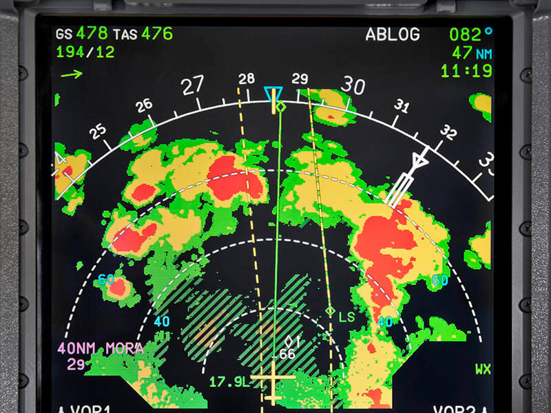
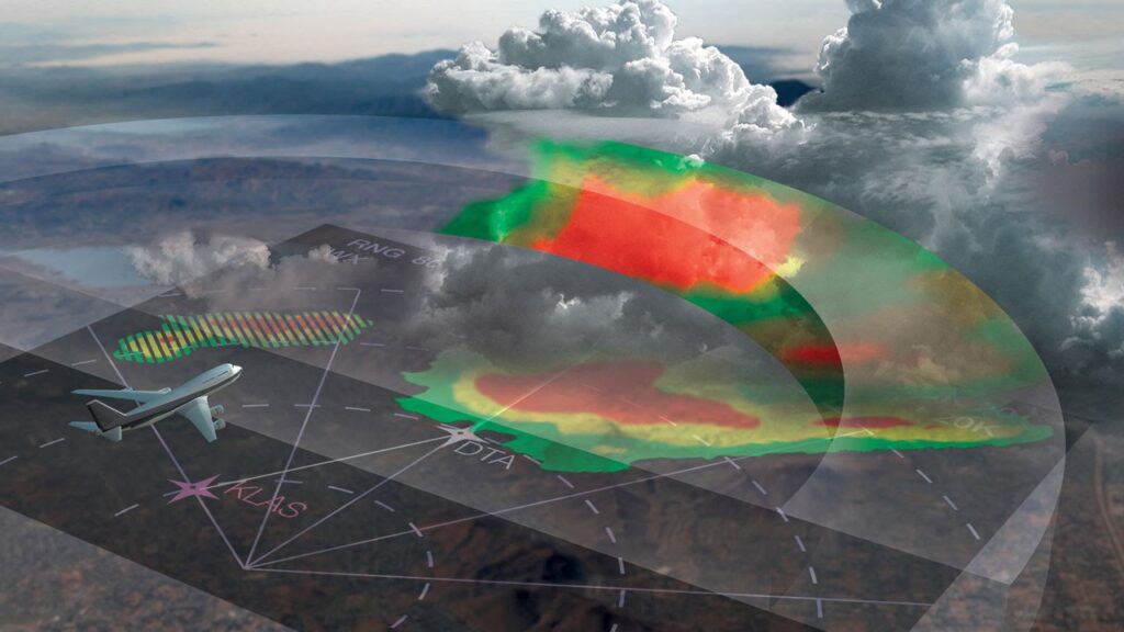
This type of Radar is used to detect particles and water droplets. The technology is to use a certain wavelength to create echo (Return of pulses) and measure it with the sensitivity of weather returns in the Radar screen. However, one of the disadvantages could be, this kind of radar may not see through nearby intense weather cells to further weather cells beyond. So, therefore there would be shadow area beyond. But still, Airborne weather radar is very useful today in Aviation to detect weather ahead, the range, analysis of probable hazard, and ground mapping mode.
Pilots should know that heavy precipitation has a strong return of pulses than light precipitation. The onboard Radar receiver screen in the cockpit shows a strong return of pulses as red, the medium return of pulses as the yellow, light return of pulses as green. The most crucial weather with heavy precipitation and turbulence is depicted as magenta color on radar screen.
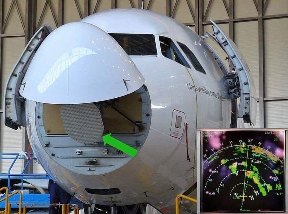
The major component of Airborne Radar systems are:
- Antenna
- Receiver/Transmitter
- Control Panel
- Display unit (usually MFD)
Understanding weather Radars, pilots need to be good at meteorology to analyze weather hazards. For example, a storm is more violent just before it rains and hail, releasing electrical discharge and visible lighting.
Airborne Radar uses C and X bands with 12 k Watts for older design, 30 Watts for fully digital radar systems. The range covers a maximum of up to 300 NM. It is important to follow the manufacturer instructions when using an Airborne radar onboard. It is possible to have physical harm (eyes) by looking into the antenna of a transmitting Radar during high energy radiation.
To be noted, not all storm cells have large water droplets initially. Nearer cells may present more radar echo than of distant cells. An extremely strong cell may also show “Hole” in the Radar screen. Strong cells which demonstrate radar echo should be avoided from at least 20 miles and to avoid two strong cells, airplane should at least 4o miles apart. If it is not possible, the pilot should consider flying one side of the pair of strong cells.
However, strong Wind shear, turbulence, or microburst can not be detected by traditional weather Radar. So, the pilot should suspect the presence of this weather phenomena if there is radar pulse return.
Moreover, there are weather Radar systems today which can also detect turbulence. The Echo is not only measured by water droplets size and density but also changes in frequency which indicates the greatest turbulence.
However, there is an important factor pilots need to remember that the Radar screen can show black areas due to heavy freezing rain or ice buildup on the Radom. Pilots also have no control over sweeping the weather radar but they can adjust the tilt of the Radar antenna, raising or lowering 15 degrees above and below the horizon. Most pilots keep the antenna on auto-tilt though, which might be not an appropriate tilt setting in critical weather situations.
The pilot who use airborne weather radar today in their flying are encouraged to take time first to learn and interpret the system involving the technology.