
VOR stands for Very High-Frequency (VHF) Omnidirectional range. This navigation has been most significant radio navigation system since 1960s. Using VOR, pilots can easily fly from point A to point B or use VOR airways. They still are very useful all over the world for many pilots aside from GPS services.
The basic principle of VOR system is not so complex. The VOR ground facility broadcast two signals at the same time. One signal is broadcasted in all direction constantly and the other signal is rotated about the ground station. The airborne equipment mounted on the airplane receives both the signals from VOR ground station and measure the difference between two signals and interpret it as a Radial in VOR display.
VOR is a short range radio navigation system which enables aircrafts to determine their location and position with relative to VOR ground station. The frequency it uses from 108.10 MHz to 117.95 MHz.
Principle of VOR ground station
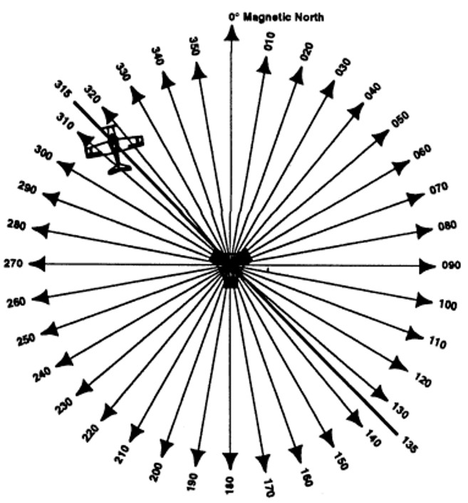
- VOR ground station is oriented to magnetic north
- 360 Line of Position clockwise from Magnetic North (MN)
- Line of position (LOP) is also called Radials
- Produces 360º radials or tracks at 1º spacing
Principle of VOR Receiver
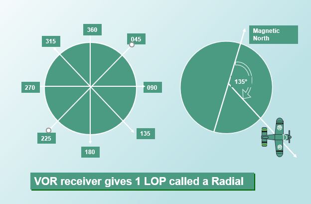
VOR receiver sense only one LOP which we call Radial
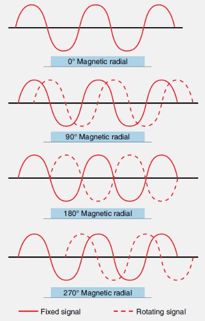
How VOR ground station Works?
VOR ground station (beacons) sends out two different signals(beams) :
1. Reference Phase ( broadcast in 360 degree constant directions)
2. Variable Phase ( Rotating beam rotates 30 revolutions per second)
VOR receiver calculate the difference between this two phases and indicates as one Radial
- VOR also sends a signal for its own identification in Morse code. We will discuss that in my another blog about navigation.
Classification of VOR
VOR signals are limited to sight. Obstacles, high terrain and the slope or curvature of the earth can vlock VOR signals. The advantage is VOR signals can be used for thousand of aircraft at the same time simultaneously. According to Range/Distance of the signals, VOR can be classifies as three types. Terminal VOR (TVOR), Low Altitude VOR (LVOR), High Altitude VOR (HVOR).
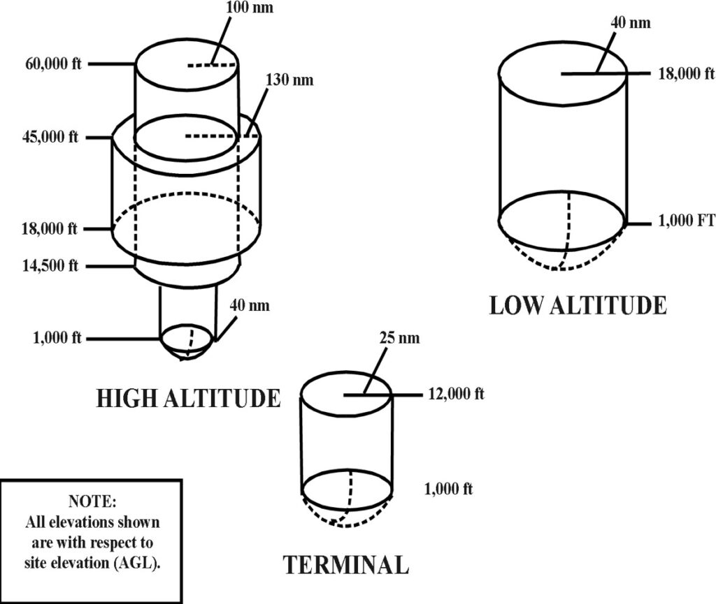
- Terminal VOR (TVOR)–
- Within 25nm and below 12,000 feet AGL.
- Low-altitude VOR (LVOR)
- Up to 40nm and between 1,000-18,000 feet AGL
- High-altitude VOR (HVOR)
- 40nm up to 14,500ft; 100nm between 14,500-18,000ft; Max range of 130nm between FL180- FL450.
Symbols of VOR Nav Aids
- VOR system only provides course guidance.

- VOR/DME and VORTAC also provide distance information to aircraft equipped with distance measuring equipment(DME).

- A VORTAC (VOR/DME + TACAN) is a navigational aid for aircraft pilots consisting of a co-located VOR beacon and a tactical air navigation system (TACAN) beacon.

VOR Airborne Equipment
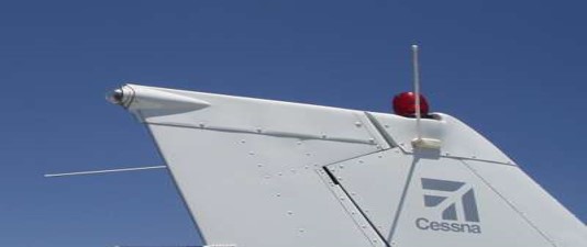
Vor Antena – Antennas are mounted on Vertical fin.
VOR panel – It has Small rotary knob, On/off and Large rotary knob, Mode selector for digital CDI, Flight plan or timer, Pull ident station identifier.
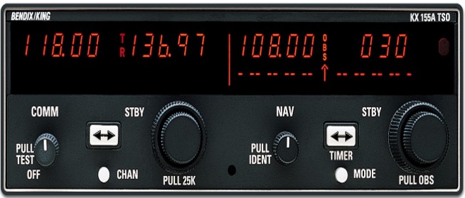
Using the panel, you can choose a VOR frequency and listen and identify the station using Morse code. Example (MCT — -.-. -)
If the station is inoperative TEST (- . … -) will be transmitted or there is no transmission at all.
Parts of VOR Indicator
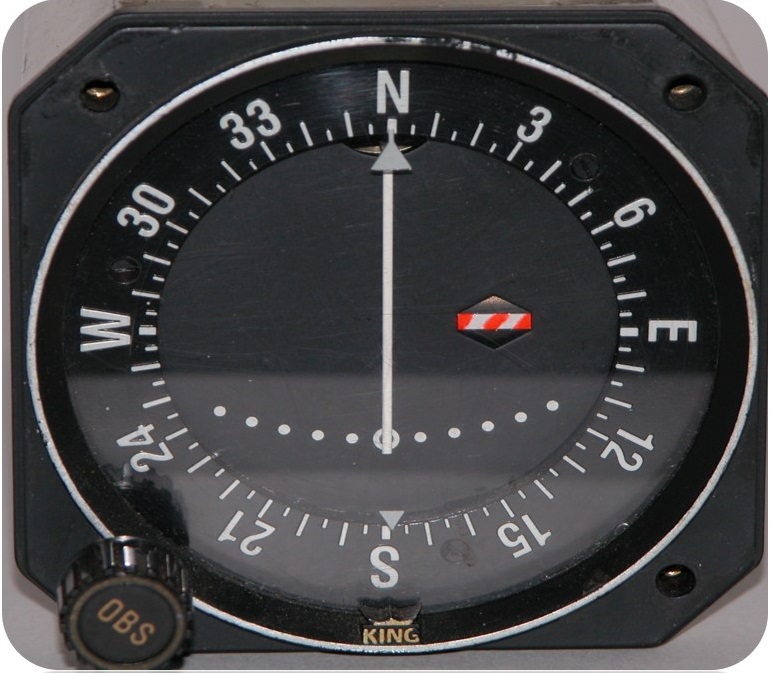
- Compass Card
- Omni bearing selector (OBS)
- Course index (OBS setting )
- Reciprocal course index
- Course Deviation Indicator (CDI)
- Course Deviation Scale
- To/From Flag
- Off Flag
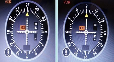
How to interpret Line of Position (Radial)
If if you want to go TO the station, Center the needle with “TO” indication and fly the new heading/reciprocal of Radial above Course index.
If you want to to fly FROM the station, center the needle with “FROM” indication and fly the new heading/Radial above the course index.
These are the very basic of VOR navigation. I will discuss about advanced VOR navigation in my another blog soon. Keep yourself updated for the next blog!
Click here to visualize VOR Operation
Comment below if you have more question about VOR Navigation system.